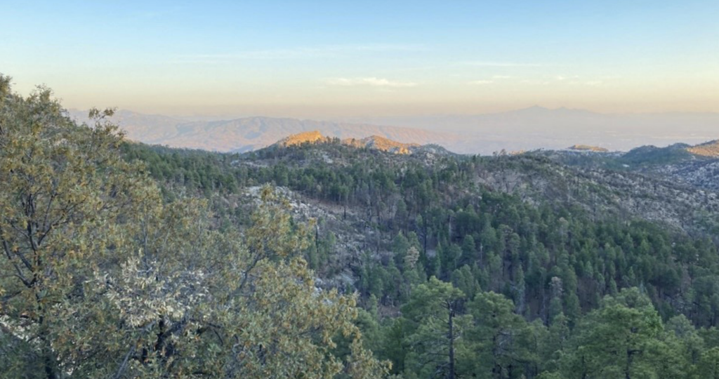
The Santa Catalina Ranger District presents final trail plan
The well-used district in Coronado National Forest, spanning more than 265,000 acres, has never before built a comprehensive trail strategy.
Its newly presented Santa Catalina Trail Plan now serves as a collaborative framework for the maintenance, improvement, and expansion of the area’s unique trail network of about 240 miles of trails, including the AZNST. These trails are primarily designated for non-motorized activities, including hiking, mountain biking, running, horseback riding, hunting, and rock climbing, with a limited portion available for motorized use.
Growth in Tucson and changes in trail usage
The plan aims to address changing trail use patterns influenced by population growth around the Tucson area, shifting visitor preferences, and advancements in recreational technology. The Santa Catalina Ranger District highlights changing trends including increased recreational use during and after the pandemic, a growing interest in mountain biking and rock climbing, and a more prominent role for outdoor recreation in the local tourism industry.
The high usage of trails, particularly on Mount Lemmon, along the Catalina Highway, and at the accessible base of the Santa Catalina Mountains, has led to adverse consequences, including trail deterioration, user conflicts, and the unauthorized creation of trails.
Lacking trail maintenance and management
The Santa Catalina Ranger District notes that many existing trailheads and access points are inadequate or not legally secured. The current trail system offers limited opportunities for beginners or individuals with mobility limitations. They also point out that the Bighorn Fire of 2020 affected over half of the trail system, altering recreational settings and compounding the challenge of trail maintenance.
Goals of the Santa Catalina Trail Plan
Santa Catalina’s stated goals include:
- Create a system of trails and trail access points that will meet the needs of current and future users, while seeking balance with resource availability and capability.
- Improve trail conditions and quality.
- Mitigate the proliferation of unauthorized trails.
- Effectively manage trails to reduce user conflict.
- Advance non-recreation program goals with recreation management, where possible.
Notable proposed trail changes
Several trails in the Santa Catalina Ranger District are slated to receive changes.
- Bush Corral Trail: Would remove lower 4 miles and connect to Green Mountain
- Bug Springs Trail: Would reroute a portion of the upper hike-and-bike section.
- Cañada del Oro (CDO): Would reroute the lower 1.4 miles out of drainage, and rename Red Ridge; remove a 5.25-mile portion between Samaniego and Red Ridge from NFS; rename upper portion Samaniego.
- Catalina Camp Trail: Would move an AZNST segment from upper Oracle Ridge to this trail.
- CDO Link (Pusch Ridge): Would remove this entire section from the NFS.
- Davis Spring Trail: Would connect to Knagge for a smaller loop trail; remove lower 4.75 miles from NFS.
- Esperero Trail (Pusch Ridge): Would connect with Sabino Overflow Lot via adoption of a current unauthorized trail.
- Evans Trail (Pusch Ridge): Would remove the entire 5.1-mile section from NFS.
- Finger Rock Trail (Pusch Ridge): Would connect with Pontatoc Trail.
- Green Mountain Trail: Would undergo multiple short reroutes under 500 feet in length to improve sustainability.
- Knagge Trail: Would connect to Davis Spring for a smaller loop trail; remove lower 2.1 miles from NFS.
- Marshall Gulch Trail: Would extend and connect to Summerhaven proposed parking project.
- Oracle Ridge Trail: Would move AZNST off of the upper portion to Red Ridge and Catalina Camp.
- Palisade Trail (Pusch Ridge): Would connect to Palisades Visitor Center.
- Pima Trail (Pusch Ridge): Would implement small-scale reroutes and drainage improvements in the vicinity of Pima Saddle to improve trail sustainability.
- Pontatoc Trail (Pusch Ridge): Would extend the trail to create a loop with Finger Rock and remove 0.9 miles from the end.
- Red Ridge Trail: Would reroute small segments for sustainability; reroute the lower portion to reach Charouleau Gap and connect to 50 Year area; move AZNST upper to Red Ridge.
- Samaniego Trail: Would complete reroutes in the lower section, just south of Charouleau Gap to improve sustainability; the middle portion would have 5.28 miles removed from NFS; the upper portion would be extended to Sutherland Trailhead, currently named CDO.
- Upper Tanque Verde Falls: Would improve and connect as part of Tanque Verde Falls Recreation Enhancement Project.
- Wilderness of Rocks Trail: Would implement small-scale reroutes.
The Santa Catalina Mountains’ historical significance
For centuries, the Santa Catalina and Rincon Mountains have been utilized by various communities. The Tohono O’odham people and their ancestors resided in the lower regions and frequented the mountain peaks and forested areas long before the arrival of Spanish, Mexican, and Anglo settlers to the area.
The present recreational trail network is, in part, based on historical routes used for hunting, gathering, or spiritual purposes. Subsequently, these routes were adapted for transportation and firefighting, particularly before the construction of the Control Road in 1920 and the Catalina Highway in the 1950s. Historical access routes such as Box Camp, Soldier, and Knagge trails have been acknowledged.
In its plan, the Santa Catalina Ranger District says, “The purpose of this project is to create a system of trails that will be ecologically, economically, and socially sustainable. It seeks to make that system a reality through thoughtful planning and open collaboration with partners and the community.”


0 Comments