UPDATE: The Mud Springs prescribed fire that was scheduled for 10/25/23 has been postponed. The reduction of hazardous fuels effort could take place as early as 10/29.
Others prescribed burn work is set to take place soon:
Fire managers plan to begin the Little Prescribed Fire on the Alpine Ranger District starting October 29. The project area involves 2,445 acres and is 1 mile east of Alpine, north of Luna Lake. Project boundaries are east of County Rd. 2117 (Forest Service Rd. 275) south and west of Little Creek, north of Luna Lake campground. Smoke could impact Highway 180 and the town of Alpine
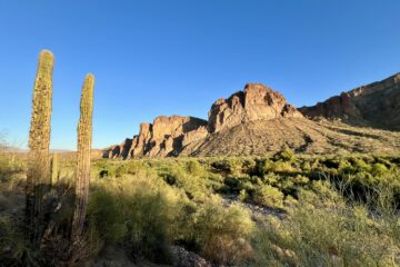
Apache-Sitgreaves National Forests
This week, the prescribed fire managers will move their operations to the Apache-Sitgreaves National Forest’s Lakeside Ranger District in preparation for the Mud Springs prescribed fire scheduled for Wednesday, October 25th. Apache-Sitgreaves announced that the prescribed fire encompasses 1,829 acres and is located approximately 3 miles south of Vernon. Fire officials are advising residents of Vernon and the nearby areas to expect temporary smoke effects. You can monitor air quality updates at https://www.airnow.gov/.
The defined project area extends along and includes:
- Forest Road 224/Apache County Road 3140
- Forest Road 5B
- Forest Road 5
- Forest Road 3D
- Forest Road 44
- Forest Road 3
Firefighting teams anticipate that smoke may be visible from Highway 60 and 260 for a few days following the initial ignition, but it should progressively diminish each day.
Trails Near Mud Springs Prescribed Fire Possibly Affected
Always consult trail and park management about trail conditions, closures, and access and restrictions before heading out. These trails or access to them near the prescribed burn may be affected during the burn’s schedule timeframe starting Oct. 24, 2023:
- Land of Pioneers, a moderate 9-mile loop trail.
- Buckelew Spring, an easy 1.2-mile out-and-back trail.
- Lake Mountain Trail, a moderate 2.6-mile out-and-back trail.
- Cerro Trigo, a moderate 1.7-mile out-and-back trail.
- Whiting Knoll, a moderate 1.2-mile out-and-back trail.
Prescribed Fires Dependent Upon Weather Conditions
The decision to proceed with the prescribed burn is contingent on an evaluation of weather and fuel conditions to ensure they align with the established burn plan criteria. If fuel moisture, temperature, wind, or humidity fall outside the prescribed parameters, the project may be canceled. Multi-day prescribed fire operations require daily assessments of conditions and approval from the responsible officer before they can continue.
Planned Fire to Reduce Dangerous Wildfire
Prescribed fires are a valuable tool for restoring ecosystems that depend on fire and reducing the threat of high-intensity wildfires. Fire managers employ prescribed fires to enhance forest health, eliminate dangerous fuels, bolster firefighter safety, improve wildlife habitats, and safeguard communities and watersheds.
These landscape treatments, like the one planned for the Apache-Sitgreaves National Forests, are consistent with the Forest Service’s 10-year Wildfire Crisis Strategy, which aims to increase the use of fire and other treatments to enhance forest health.
Contact the Ranger Before Using the Trails
Visit the A-S National Forests website at https://www.fs.usda.gov/asnf and follow them on Facebook https://www.facebook.com/apachesitgreavesnfs.


0 Comments